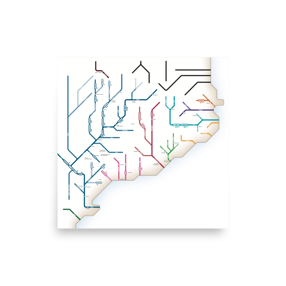
Road map of Catalonia
This map represents the roads of the Catalan Basic Network in 2021 as a Metro map, with the colors assigned according to the numbering criteria implemented by the Generalitat de Catalunya in 2001:
- Orange: North-South axes (C-1x)
- Green: east-west axes (C-2x)
- Red: axes parallel to the coast (C-3x)
- Dark blue: axes perpendicular to the coast (C-4x, C-5x, C-6x)
Other routes are also represented:
- Lila: Motorways
- Turquoise: Highways
- Grey: national roads
- Green and magenta: local roads
The division into vegueries, regional capitals and other reference towns are included in the map to improve understanding of the map.
Attention to detail: in the knots where not all possible movements are integrated, those that are are indicated with arrows.